| Cycling east Canada and USA |  | |||||
 |
 |
 |
 |
 |
 |
 |
| Nothing compares to the simple pleasure of a bike ride. J.F.Kennedy | ||||||
| Statistics |
| Map of route |
| Miscellany |
| Profiles |
| Selected photos |
| E-mail the author |
| Writings from a trip |
| Québec |
| Newfoundland |
| Nova Scotia |
| New Brunswick |
| Maine |
| < Massachusetts > |
| New York |
| Washington D.C. |
| Virginia |
| Carolinas |
| Florida |
| Other trips |
| List of trips |
| Search |
| Four-month cycling trip, starting in late July 2013 in Quebec, ending in Orlando. Author's 10th expedition (New Zealand, Australia, USA, Canada, Alaska, Japan, Mexico, Bolivia, Chile, Argentina, Namibia, South Africa). |
|
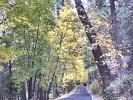
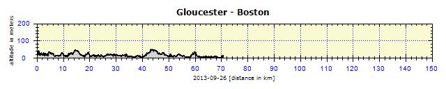
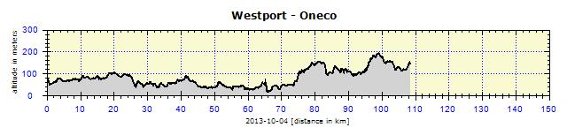
Massachusetts, Rhode Island, Connecticut Salisbury, Rowley, Gloucester, Beverly, Salem, Cambridge, Boston, Plymouth, Ellisville, Sandwich, Brewster, Eastham, Brewster, Hyannis, Falmouth, Woods Hole - ferry - Oak Bluffs, Vineyard Haven, Edgartown, Sound Beach, Oak Bluffs, Vineyard Haven - ferry - Woods Hole, Falmouth, Bourne, Acushnet, Westport, Freetown, Berkley, Dighton, Rehoboth, Providence (Rhode Island), Oneco (Connecticut), Voluntown, Mystic, New London - ferry - Orient Point (New York) My first task was to get a map to locate a campsite where I could stay. At the entrance to Salisbury RV Park, I asked them politely for a map and received one with roads marked North of Boston and a Boston city center map. Two campsites were located about 40 km away, but it was unclear whether they were open. I had about three hours left, as the days were short and the sun set shortly after 7 p.m. I decided to try to reach Cape Ann. I had not seen any proper food store during the whole day and was as hungry as a wolf. Ipswich had a big supermarket called Shaws. They served three types of soup. I quickly consumed a delicious chicken soup, which contained at least a quarter of a chicken and some broad noodles. This energized me and thereafter I rode like the wind. It is interesting, I am never energetic in the mornings and I cycle lazily, but then in the afternoon my aged body wakes up and I feel like a king and the pedals spin on their own like the wind without any effort. Before Gloucester, I saw a sign to a campsite. There should have been a second campsite only 2 km further on along the same road I was on. However, my instincts told me to turn off to the side road and cycle the approximate 6 km to that campsite, over short steep hills. The campsite was open, with tent pitches on nice grass in a forest. Nearby was a water faucet and I was all alone there. The other facilities (shower and bathrooms) were in a terrible state. Nevertheless, they charged the standard rate of $25. The showers worked with dimes and started working only after my complaint to the office. I was a little angry at myself for choosing that campsite, when I could have gone on to the second one. However, the next day revealed that my instinct to turn off to this one had been correct. The second one was closed, so I would have had to return anyway. TThese were silly problems, though. I needed to find accommodation in Boston, which has no campsites in the surroundings and where accommodation is known to be pricey. It was nearly impossible to find overnight accommodation for less than $200. I searched the Internet till late at night. I found a hostel which, apart from dorms, also had private bedrooms. I also located Farrington Inn, which charged $110, with a minimum stay of three nights. I left it to the morning, planning to call the hostel to check whether they had a single room. I avoid sleeping in dormitories. The following morning, I tried using the public phone in the camp, but it was not working. The camp owner offered me the use of her cell phone. The hostel had a bed available in an 8-bedded dorm on the Thursday for $65, a single room for $120 on the Friday, and again only a dorm bed on the Saturday. Reserving at Farrington Inn was unavoidable, and also recommended by the camp owner. The hotel is located in a good quarter where many students live. She let me use her computer where I quickly made my booking and then started out on my journey. I was still in doubt as to whether I should have tried my luck instead to find a cheaper hotel near a subway station. However, it was a good thing I did not do it, or I would have spent loads of time searching and the price would not have been much lower anyway. I was all set up. I entered the address into the GPS, it displayed the destination at 70 km via the cycling route. I had plenty of time, so I started off calmly. This calmness was ruined by the chain which broke on a steep ascent. Luckily, it was only the chain connector which had opened. I use a SRAM chain with openable connector, which probably was not properly clicked into place. All the saddle-bags were removed, the chain repaired in five minutes, yet it had been impossible to keep my hands clean. I started the repair with plastic bags on my hands, but when I needed to snap the connector in, I had to use my bare hands, so I ended up as filthy as a pig. A hand disinfectant helped me to remove the worst grease.
First Compatriot
My next stop was Salem, a city known for its inquisition processes against alleged witches in the 17th century. This period was effectively described by Nathaniel Hawthorne in his novel, "The Scarlet Letter". One of the main streets of the city is even named after him. Their entire tourist trade is based on the events of that time. Americans excel at such things! Prague could also pull up several impressively morbid stories (the execution of 27 Czech noblemen, Ketch Mydlář, Golem and others). The stories could be edited, simplified and made available to the public. A tourist theme could be made out of them.
The Leading Role of GPS
Boston
It is funny how one learns to orientate oneself in such a big city. On the first evening, I explored the hotel surroundings. It is located near a student quarter – the huge University of Boston is only four blocks away. A reasonably nice suburb with non-aggressive immigrants. Many Russians reside there and I came across a Bazar supermarket selling pirozhki, blinciki and other such 'delicacies'. However, they had delicious frozen pelmeni, the Siberian ones were the best. They sold them by weight. I scooped them out into a plastic container with a metal spoon and ate them in the hotel, licking my lips like a cat. On the next day, I visited the city center, discovering how the transport system worked.
Boston is connected to the American Revolution and the War of Independence which led to the Declaration of Independence. A battle took place on Bunker Hill, where there is a big monument today, a tall obelisk. A marked route through Boston leads past all the landmarks connected to the Revolution. I went through all of them thoroughly. For a fraction of the price it would cost in a supermarket, I bought some delicious fruit at a market. Near the market, I stuffed myself with an excellent calzone and pizza in a crowded pizzeria run by American Italians with gelled raven-black hair. I wandered around the city, enjoying the late afternoon sun, after the cloudy day. I do not have time to describe Boston in detail – check out the photos instead.
The Boston Street Piano Festival
Museum of Fine Arts
A curiosity – in the abstract art section, there was a piece by Andy Warhol, created by an unusual technique. He urinated on to a painted plank and when it had dried and lost the stench, quickly ran to the Gallery with it. This Boston work was probably created in the master's later years, when the stream was no longer so strong and instead sprayed the surroundings (usually not appreciated by housewives). His hand also seemed a bit shaky, he did not seem so confident in handling a paintbrush either. By the way, in the US, they claim that Andy was born in Pittsburg, and not in Eastern Slovakia.
Harvard
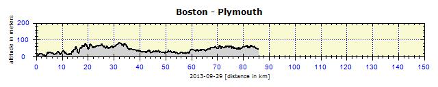
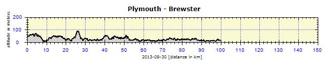
My next destination was of a natural character: Cape Cod – a cape jutting out into the ocean, crowned by two islands – Nantucket and Martha's Vineyard – favored by the American elite. The GPS led me without any errors out of Boston and along pleasant roads for cycling. It took me via narrow, less frequented local roads and, by the afternoon, I had already reached a campsite on the outskirts of Plymouth. I still lacked a road map for Massachusetts. I would have to get hold of one in a Tourist Center, there was no need to buy one.
Plymouth
I needed information on Cape Cod, mainly the campground locations and the possibility to camp on Martha's Vineyard island, which I longed to see. I was inundated with brochures at the Information Center. The lady was fixated on her red highlighter pen, so she also circled every single item in the brochures that she mentioned to me. I had my hands full of highlighted brochures, but had actually learned nothing. Finally, she sent me to the Massachusetts State Info Center. It was just a few kilometers away, at Exit 5 of Highway 3. There the process took only two minutes. I was given a list of campgrounds, an official road map of the State and ferry timetables to Martha's Vineyard. Cape Cod has about 10 campsites, so I made no plans and left it to fate to see how far I would get that afternoon.
Two-faced Police
It was really no pleasure. The bridge was narrow, no emergency lane, the lanes were narrowed down to the bare minimum, so it was no wonder I felt stressed. After some time, an intelligent driver drove behind me and turned on his warning lights, to announce to other drivers that he was driving slowly. In the afternoon, I found a campground suitable both for its price and location. Some campsites there were charging $45 for a tent pitch –that is really exorbitant.
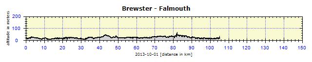
The next morning, I went on to a magnificent cycle track, leading along an abolished railway line. Surrounded by greenery and through several tunnels – beneath the roads. Mushrooms were growing alongside the road. Nobody was collecting them. Wait until the Russians from Boston move there, they will pick them all! I reached Cape Cod National Park. The Visitors' Center and bathrooms were closed. The Federal government had no money, so they had discontinued their administrative work. For sure, no-one would show their gratitude to Obama for that. Already beside the road I saw banners picturing Obama urinating in his own sand box.
First of all, I wanted to reach Martha's Vineyard from Hyannis and then return to Woods Hole. But there was only one campground in Hyannis, only for RVs, with tents not permitted. So I decided to go on to the Falmouth campground, which is only a few km from Woods Hole harbor.
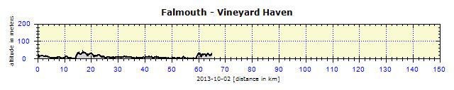
While enjoying my breakfast, I had read in a free newspaper about the cost of the completion of a library building. Discussions about money to be used for public purposes were often exaggerated and escalated by the local media. But suddenly, I ran out of time, the ferry back to Martha's Vineyard was departing in 40 minutes. I was not yet packed, with 10 km ahead of me. Luckily it was an easy cycling road. It would not have been a tragedy to miss the ferry, as there would be another one in 75 minutes. But I wanted to make it. I stepped on the pedals with all my strength, shouting at other cyclists: "Watch out from your left!", arrived at the harbor and boarded the vessel as the last passenger just before departure. I was lucky that I had bought my return ticket in the campground already ($8 for me, $4 for the bike, one-way). The ferry stops either in Oak Bluffs or, more frequently, in Vineyard Haven. It makes no difference, however, as the harbors are 7 km apart. I reached a campsite 10 km away. There was no-one in the office or in the campsite, only instructions on how to choose a good site and to pay in the evening. It was the end of the season and they would be closing the following week. I left the bags in the tent and, feeling as light and free as a bird, set off to see the island. Right in front of the camp, I saw a good quality cycling track to Edgartown, connecting to another track to South Beach and one to Oak Bluffs. Heaven for cyclists! First of all, I wanted to cycle around the island, but was discouraged from it by locals who said that the normal roads were dangerous. They are narrow, hilly, with a lot of traffic. Finally, the good weather influenced me to relax and cycle in a laid-back style. How often does it happen to have a daily temperature of 27 degrees at this latitude and at the beginning of October? And it had been like that for the past 11 days.
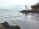
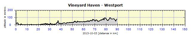
The campsite turned out to be one of the most expensive. I paid $43 after the discount. So I informed the owner about the prices on the West coast in 2006, when the hiker/biker part of State camps cost between $2 and $5. He explained that those times were long gone. The camp-owners demanded that State campgrounds should not charge those unfairly low prices, thus seriously competing with private campgrounds. Therefore, State camps normally charged $25. I cycled back northwards to Woods Hole, along the whole 17 km long cycle track along the coast, admiring the picturesque Sippewissett Marsh. The bridge in Bourne was no problem. Following recommendations, I pushed the bike along the narrow pedestrian pathway. At least I had time to take some photos from that height. On the list of campgrounds I found another, still open campsite, more or less on the route to New York. I entered the address into the GPS cycling mode, and passed along Fall-decorated local roads with minimal traffic.
Bridges, goddamn Bridges
Rain had to come one day
I continued rather blindly, taking a chance on finding accommodation. The GPS displayed a campsite roughly on my route. I had no idea whether it existed or if it was open. I was guided through a forest and hilly scenery, no civilization, an odd farm here and there. I was ready to bivouac into the forest beside the road. But then I crossed the border into Connecticut State, and saw a roadside store where I bought some beers. According to the GPS, the campground was 4 km away, but in the store they sent me to another one which was only 2 km away. It was poorly equipped, with dirty showers and bathrooms. The owner asked for $20 cash. But I was happy anyway, I had a place to sleep. An advantage was the fact that the camp had no WiFi, so I cooked my dinner and, before 9 p.m., was already in my sleeping bag. I slept until 6.30 a.m. The weather was lousy, with heavy rain drumming on my tent. Trust me, this makes sleeping easy.
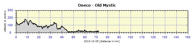
It had rained throughout the night, yet the weather in the morning was still uncertain. I quickly packed up my tent, so I would not get caught in the rain. I even managed to have breakfast without getting wet and could continue the journey without having to wear Gore-Tex. The GPS led me via colorful roads, on which I hardly encountered any cars. Ideal weather – it was not raining, it was not hot, not blowing. I knew I had loads of time. Accommodation in NY was booked from the Tuesday. I had no reason to rush. So, instead of trying to catch a ferry to New London, I went to see Mystic, a small seaside town with a cute drawbridge in its center and with many fashion stores in the main avenue. Those were outside my interests, I was only interested in supermarkets and grocery stores.
I obtained some new information from the Tourist Office. There was no campground in New London, 18 km away. The ferry departed every 2-3 hours. From Orient Point to Long Island it is about 170 km on the highway leading to NY. I decided not to rush, the campsite was only 7 km out of Mystic. I had time to explore Mystic and the surrounding coastal villages. I would then have a 'service day' in the campsite: washing clothes, shaving, oiling the chains and, in the proper manner, myself as well. I asked for a State road map of Connecticut and received it after some hesitation from the lady at the Information Center. It was very common there: the commercial maps were for sale, and the State ones, which were free, were usually hidden from the displays. But if you asked nicely, they understood that you were an expert, and handed you the free map with a smile on their faces. The GPS surprised me when it calculated the cycling route to New London as 42 km. It suggested a detour via Norwich. It was clear to me – again another bridge problem. No-one in the campground knew if it was possible to cycle over the Thames River bridge. Luckily, I found a photo of the bridge on the Internet, which showed a footpath for pedestrians. It would somehow be possible to cross over it. Before 6 a.m. it started to rain. At first, only lightly, so I quickly packed up my damp tent, before the downpour really started. I moved with my bike under a shelter, made breakfast and waited to see how the weather would progress. I started off in only a slight drizzle in the Gore-Tex, which I was able to take off after about 12 km. The road over the bridge was surprisingly easy to find – via a side street close to the bridge – and the pedestrian and cycle path began under the bridge. I reached New London harbor at 10.50 a.m. The ferry to Long Island was to depart at 11 a.m. I boarded the ferry for just under $20 (pedestrians $15.40, bikes $4). I ordered the obligatory coffee, which I only drink on ferries, and something light to eat. In this respect, I act like the Americans, who eat at every occasion. Two hours later, I disembarked from the vessel and entered the State of New York.
        |


