Nothing compares to the simple pleasure of a bike ride. J.F.Kennedy
Search this website
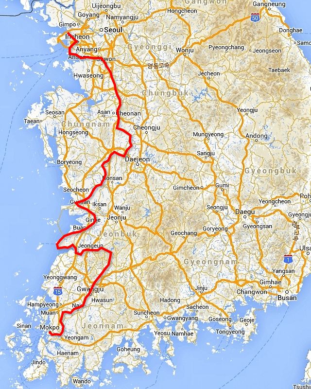
West Coast
Incheon, Ansan, Suwon, Pyeongtaek, Cheonan, Sejong, Gongju, Buyeo, Gunsan, Buan, Byeonsan, Seokpo, Jeongeup, Chuwolsan, Damyang, Gwangju, Naju, Mokpo
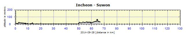
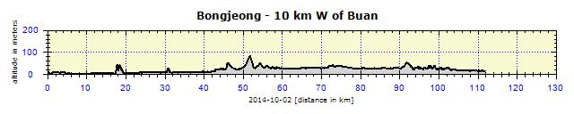
Tired, as I was catching up on my blog and had only got to bed at 01:30, I started cycling southwards. Incheon is a big city, so I entered a small town in my GPS, about 60 km south of it. The navigation gave me strange instructions, so I turned it off, used my own head and the printed map, located Road 77 and arrived at the coast. Stopping all the time at traffic lights, streets filled with cars, simply a big city. At the seaside, I found myself in an unattractive industrial agglomeration before locating an unused side road. Due to the environment and cloudy weather it was all a little depressing.

Incheon: The water level fluctuates greatly with the tide
I studied the map in Ansan and noticed Suwon city. It rang a bell, so I took out the Kindle and found in the guide that a large fortress was located there, also listed by UNESCO. Of course I headed there. Road 42 looked like a highway, dense traffic, but with a wide side lane and bicycles were not forbidden. Every few km, other roads connected or exited, which was quite unpleasant. I constantly had to check my rear-view mirrors in case someone accidentally bumped into me. On the way to the fortress, I had to cross over to the other side of the street, where there was a bridge for pedestrians, but with a large enough elevator for me and bicycle to fit into it easily. Then I had to get over the station – a narrow, busy street passed beneath it. I chose the safer alternative – over it – I took the elevator up, over the foot bridge and went down again in another elevator.

Suwon: Road 42 along which I rode – not really a highway but nonetheless uncomfortably busy

Suwon: Crossing Road 42 – the footbridge is equipped with an elevator which I used even with my bicycle
Hwaseong Fortress
I was surprised by its size, bulwarks with watchtowers stretching for several km. Around the bulwarks was a cycle path – so I cycled around it. I walked on the walls and found that the interior of the fortress was both a normal city, as well as King Jeongjo's Haenggung Palace, which is often used in Korean historical movies. I liked it there. I found a good, cheap hostel and went into the Fortress to see it properly.
")
Suwon: Hwaseomun gate and Seobuk Gongsimdon watchtower (left)

Suwon: Tower at Hwaseong fort

Suwon: Janganmun gate

Suwon: Seojangdae pavilion situated high above the city

Suwon: SeoNodae – a base for catapult fire

Suwon: Walls of the fort are several kilometers long

Suwon: Suwoncheon creek flows through the fort

Suwon: Hwaseong Haenggung Palace is located in the fort

Suwon: Entrance gate to Hwaseong Haenggung Palace

Suwon: Paldalmun gate is in the middle of a roundabout

Suwon: Hwaseong fort is surrounded by the growing city

Suwon: Altar in the small Seongsin Temple sanctuary
Due to the lack of sleep I faded out at 21:00 already and slept like a baby. The following morning I found out why – it had poured with rain all night, grey skies everywhere, sometimes black, and the rain was not easing off. I waited until 09:00. No sign of improvement, so I paid for another night. There was no point in stepping out of that building in the morning hours, so I dealt with necessary tasks on the Internet. The rain eased off a bit in the afternoon, even stopped for some moments, and then started continuously again. I put on my waterproof clothes and went to the Fortress. Of course, I skipped wearing socks, so I would not have to dry them. I walked around most of the Fortress' bulwarks, took some photos, and was upset about the weather, which greatly affected the quality of my photographs, causing them to look under-exposed. The views of the city were obscured by the rain and mist. Bad luck. The forecast promised a weather improvement the following day, so I hoped I would be able to go there again then.

Suwon: Jidong marketplace – sales even right on the street

Suwon: Preparing delicacies at the market place
Direction Sejong
Thanks to the unplanned stay in Suwon, I had the opportunity of reviewing my next steps. No great plans, though, that would not have been my style. However, I needed to figure out my destination for the next day. I remembered two bike paths along rivers and headed towards the more northerly one, along the Geum River. If you check the map, you will probably find Geumgang, gang is 'river' in Korean. I located the closest city to the Korean interior on Garmin on my GPS. The problem with GPS maps of Korea, Taiwan and Japan is that Garmin does not have their official maps in its City Navigator. So I use Open Source maps instead, which are not complete and seem to have a different transcription of local places. However, finding routes by using the 'cyclo' mode is disastrous. If I had followed them I would have cycled 50% more than necessary. So I try to use it only to get out of a city and then prefer using printed maps and my common sense.

Seonghwaneup: Roadside scenery
Suwon could be compared to Prague as far as population is concerned and it is connected to two other cities: Dongbu and Osan. There were many bypasses due to new road construction. Finally I could cycle for a bit without stopping at red traffic lights. In the following cities, Pyeongtaek and Cheonan, I used Road 1 – although busy, it had a reasonable side lane. Big supermarkets along the way supplied me both with immediate food and supplies for the following days.

Sejong: Road 1 runs through the city in tunnels or covered like this, apparently because of the noise
The official name for Sejong is "Sejong Metropolitan Autonomous City." The State decided to build a multifunctional administrative city, to lead Korea into the future. The city is designed for half a million inhabitants and should be completed by 2030. People are already living in it at present. So many business enterprises are already attracted to it. I expected some futuristic architecture, but I only saw dense multistory houses, reminiscent of Prague's Jižní Město. In truth, the majority of Korean buildings have 30 floors, that would not be seen in Jižní Město. Nevertheless, the developers seriously undertook the planning of traffic and Road 1, which goes through the city. The road is embedded in tunnels underground and the exits are covered in order to dampen the noise. This was annoying for me. I could bypass the first tunnel on another road, but I had to push the bicycle through barriers at the entrance to a road under construction in order to bypass the second tunnel.

Sejong: The newly built blocks for 500 000 people reminded me of the overpopulated south city part of Prague
Bike Path along the Geum River
I reached the Geum River and everything was fine: I had reached the bike path. Quite late in the day with 120 km behind me, I was keen to find a place to sleep. I succeeded in a flash. 2 km later, a small Buddhist temple appeared on a hill, with a water source and a flat wide cut meadow below it and with the top floors of multistory buildings overlooking it. Other people were coming to collect water, so I did not even read the water analysis next to it (it was in Korean) and drank the water without hesitation. After dusk – so I would not offend anyone by my naked backside – I washed properly at the spring and all was well with my world.

Sejong: The water well also served as my bathtub

Sejong: I stayed overnight under surveillance of the 30-story skyscrapers

Sejong: I was woken up in the morning by energetically exercising pensioners
Bike paths are easy – usually on a separately dedicated road, with only some parts leading on to a vehicular traffic road. Drivers are informed by various means when a road is also shared by cyclists. Korean cyclists do not seem to be keen on cycling up hills, so the trails are designed with the minimum number of ascents. In some parts, it must have cost enormous sums of money. For example, a section where the trail stretched for several kilometers on pylons beside a river. I only passed three cyclists that morning. I found their attire strange – not the parrot-like colors, that is their style, all their leisure clothing is very colorful. But they cycle in long trousers, a jacket with the face covered from neck to nose like some terrorist, even in hot temperatures of 35 degrees. I asked them about it and they explained that it was protection against the sun. I figured that they seem to value pale skin and try to avoid being tanned.

Sejong: Sunrise over Geum River

Sejong: Sejong is across the Geum River

Jangam-dong: Installation in Seokjangni Museum
Baekje Cultural Festival
After 20 km, I entered Gongju and gaped in wonder. Huge structures next to the river, with a temporary pontoon bridge covered by dragons, horses, boats and heaven knows what else. The Baekje Festival was taking place, on top of that, it was the 60th anniversary of the Festival. The Festival lasts for 10 days, celebrating the Kingdom of the same name which ruled this region until 660 A.D. Plenty of food stalls. Although it was straight after breakfast, I immediately ordered fishcakes and washed them down with several bowls of clear soup. I paid nothing for this – a Korean cyclist who was eating the same food next to me covered the cost (about 10 CZK or $0,5). Eomuk, also called odeng, is a fishcake in the shape of a broad noodle, served on a thick stick and served with an unlimited quantity of soup, which you serve yourself from the pot. The specialty of this region are chestnuts and I had to admit I had never eaten such good ones before. Firm and tender, not the flour-like consistency like back home. And also very tasty with a sweetish nut flavor. Delicious, I had to order some more.

Gongju: Decorated boats in the riverside canal

Gongju: The Baekje Festival decorations were majestic

Gongju: I had eomuk here
Gongsanseong Fortress
Gongsanseong Fortress is situated on the promontory above the Geum River. In the interior, as opposed to the Fortress in Suwon, was a forest and several atypical houses. Wooden houses usually burned down, so it was quite rare to see a wooden house a few hundred years old. The bulwarks were authentic, without the many concrete repairs as in Suwon. Deep green interior area and misty blue river on the outside — magic! I was really taken by that place and spent nearly two hours there.

Gongju: A group of pensioners marching into Gongsanseong Fortress

Gongju: Entrance gate to Gongsanseong Fortress

Gongju: Gongsanseong Fortress –they were organizing banquets in Imnyugak

Gongju: Gongsanseong Fortress – one of the buildings is Yeongeunsa Temple

Gongju: Gongsanseong Fortress – the Manharu pavilion beside the deep 'pond'

Gongju: Geum River area through which the bike path goes
I continued for less than 1 km before coming across another site – the tombs in Songsal-li. These were built differently from the later ones of the Silla Kingdom in Gyeongju, where they had built a massive wooden cabin for the burial of bodies. Everything was then covered with soil and the wooden tomb collapsed over the corpses in time. Although the massive tomb would be as useful as a jacket to a dead person, it was clear that their work had not been done thoroughly. The Baekje Dynasty worked more thoroughly and built stone cells, lined with burnt tiles which, even after being covered with soil, did not collapse. Both the interior and exterior of the Baekje tombs were impressive and worth spending time in. Moreover, during the Festival, all entry fees were abolished, which was nice. Koreans are very reasonable: the entry fee was usually only symbolic – often 20 CZK ($1). The most I paid was about 100 CZK ($5), but that was an exception.

Gongju: King Muryeonga's grave

Gongju: Dragon on the wall of King Muryeonga's grave

Gongju: King Muryeonga's grave
Neither the chestnuts nor the fishcakes fought off the ever increasing hunger. I went to Hanok Village (a traditional village), stopped in a packed restaurant and ordered 'bulldog.' This was my mnemonic aid to remember bulgoki, marinated beef served in broth. I could really eat my fill, as it was served with rice which has the ability to fill one up. However, I could not leave yet, as right across the road was the Gongju National Museum. It housed a very impressive permanent exposition dedicated to the Korean-Chinese-Japanese influence and cultural mixes. This was finally followed by an exposition of artistic artefacts of dubious quality called "It is not a Toy."

Gongju: Gongju National Museum

Gongju: Gongju National Museum – exhibition presenting Korean – Chinese – Japanese history

Gongju: Gongju National Museum – masks
A small pearl: A group of mentally retarded youngsters was also visiting the Museum. Their minders were their peers, all together 1:1. Among them was a 20-year-old boy, one head taller than me, who immediately took a liking to me. He shook my hand and asked me to stroke him. This ritual was repeated about 20 times during my half-hour visit of the Museum. Apart from the stroking, I also patted him on his shoulders, he was in heaven and I nearly cried with emotion. I was very sad at how unfair Nature had been to this boy and gratefully realized how fortunate we were that nothing like that had happened in our family.

Gongju: Gongju National Museum – 'It's not a toy' exhibition

Gongju: Gongju National Museum – 'It's not a toy' exhibition – the dolls were quite disturbing
Water flows and therefore the weirs are also administered by the K-Water company, who always make sure that the public sees them positively. Most weirs serve as art or educational exhibitions, I have already written about that. At the weir in Baekjebo there was a viewing tower, about 20 meters in height, with both elevator and steps leading to the top .

Gongju: Geum River from the lookout on Baekjebo weir

Gongju: Baekjebo weir

Gongju: View from lookout on Baekjebo weir
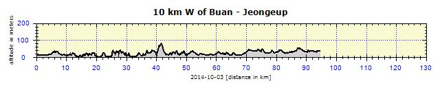
Another part of the Festival continued in Buyeo. There was a temporary pontoon bridge over the river, containing paper statues. Music, food, festivities. I had not cycled a lot that day, but I was attracted to the Festival, so tried to find accommodation. No luck! Everything was booked up. At least, I had dinner there and at sunset cycled off into the distance.

Buyeo: Paper statue on the bridge

Buyeo: The bike path across the bridge was not straight, but winding to prevent boredom
There was a small drinking fountain at a rugby field. I washed there, but as it was still light, I continued on my way. Bike paths were quite safe, even in the dark. Meanwhile it got really dark, but luckily the moon lit my way a little. I cycled for about 10 km along the river bank. The river was on the right, rice fields on the left. No opportunity to pitch my tent. Just like many times before, I thought to myself: "I really wonder where you're going to sleep tonight, buddy." Then illuminated public bathrooms appeared on the bank with a shelter just big enough to fit my tent under. There was no running water in the bathrooms, but the toilets flushed. Only a small engineering intervention was needed (to find and open the hidden faucet) for water to run into the sink, too. Naturally, I returned it to the previous state the following morning.

Gomgaenaru: Geum River ferry service operates with replicas of historical boats

Near Gunsan: Theme park and observation point for migratory birds
Food is Really Complicated at Times
I was about 40 km from the sea. Rain lasting over one hour, constant hiding under roofs and changing of clothes delayed me. Therefore I reached the end of the bike path close to Gunsan only just before midday. There were several restaurants at this busy spot, which served as a road service station. I entered the busiest one and, as I was really starving, ordered two main courses. Mandu (dumplings) were no problem – I ate them as a mere starter. Then I received a 2-liter pot of soup, with floating open shells of various types and sizes, and a bowl of noodles in 3 colors – white, green and pink. They lit the cooker under the pot and walked away. The soup was boiling, I reduced the heat and started pouring the soup into my plate, picking out the mussels with tongs and removing the meat with chopsticks. However, the noodles were tasteless and generally strange. Something was not right, I started looking around the restaurant, most people had the soup pot, too. However, they were already happily eating. I waited for a new arrival and finally realized that the noodles were raw and I first had to cook them in the soup. I waited until they became al dente to my taste and then really enjoyed a great meal. I happily state that the vast quantity of mussels consumed did not leave any destructive traces on my digestive system.

Near Mangyeong: If I was hit by a car here, I would literally be 'pushing up daisies'

Near Buan: Rice field with banners
Under the Bridge
My next destination was the Byeonsan National Park on a peninsula of the same name. I headed to the nearest big town: Buan. Quite pleasant local Road 711 with flowers along the edges. It looked beautiful, but there was a lot of work behind it, as someone would have to maintain it. Before Buan, the busy Road 23 connected to this local road, but only for a few km, I could easily bear that. I saw signs to the Sports Park in Buan and followed them for about 6 km, exited the town, but there was no park anywhere. It was getting late and I did not want to cycle on a road in the dark, so I located a river on the map and went there. Again, anti-flood bank without the possibility of camping. The only suitable place was under a bridge. I washed in the river, although it was quite difficult to access. The strong wind blowing complicated the pitching of my tent. I would normally fix the toggles in the direction of the wind, but it was hard to find suitable spots on the pavement with appropriate spacing. Finally, I succeeded and slept well through the roar of the passing cars above me.

Near Buan: I even did the classic 'tramp sleeping under a bridge' act

Near Buan: Energy Theme Park

Near Buan: A statue at the entrance to Energy Theme Park

Haechang: The little fountain transformed a dirty wanderer into a clean cyclist and, what's more, even cleaned my bike
Byeonsan National Park
Simply said – I was disappointed. Several beaches, several nice cliffs, that was all. Maybe it was because I had missed the opportunity of cycling from Gunsan on a 30 km long causeway built to stop the sea from entering the land and creating a space for new rice fields. This ecologically controversial project had many dissenters, but it was already complete. On my expensive, detailed map, there was no road on the causeway, it was marked as an anti-flood bulwark. The Korean tourist map did not have it marked at all, and GPS had it marked as forbidden to bicycles, which was not true. It would have been a detour, but a new experience. A pity.

Near Haechang: A dam, many kilometers long, now with a perfect road

Byeonsan: Beachside statue with Haseon Island in the background

Byeonsan: The beach

Byeonsan: It is off-season

Geyokpo: Jeokbyeokgang cliff

Chaeseokgang: Hotel
A positive exception was the Naesosa Temple, not remarkable from an architectonic point of view, but located in a beautiful dense forest at the foot of high hills, possibly even mountains. I was taken by the main building's decoration, with painted scenes from Hell. I was informed in detail what happened to poor sinners when they arrived in Hell. I promised to be good from then on.

Seokpo: Village in the foothills

Seokpo: Statue at entrance to Naesosa Temple

Seokpo: Naesosa Temple

Seokpo: Naesosa Temple was built in the forest below the mountains

Seokpo: Naesosa Temple – statue at entrance gate

Seokpo: Naesosa Temple – even Buddhist hell is quite deterring – so don't worry about it

Seokpo: Naesosa Temple – traditional tree decoration
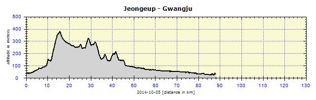
One national park had been disappointing, so I wanted to visit another one. The very popular and renowned Naejangsan Park was not far away. The nearest big city was Jeongeup, so I aimed for it for accommodation and to continue the blog and deal with necessities – mainly washing my clothes – everything was sticking to me. I reached the city just before sunset, bought food in a supermarket and entered the first of a colony of motels. The motel was convenient as it provided a cart into which I could pile all of my six panniers and, in an unguarded moment, I could even smuggle the bike into the elevator and up to my room. I was accommodated on the 5th floor, but the local custom has it that the 4th floor is omitted. In other words: 1,2,3,5,6. People are superstitious there.
Naejangsan National Park
My original plan was to cycle the 15 km to the Park where I would complete a short trek and then cycle back. On the previous evening, I checked the Internet to find that bus 171 went to the Park about every 40 minutes. My accommodation was 150 meters from the bus terminal. The next morning I saw a bus leaving the stop for Naejangsan, I waved at it and boarded it. It was not number 171, but took me to the right destination. The route to the Park was not marked in that small town. The Park was about 4 km away from where the bus had dropped me. But I did not know in which direction. Luckily, the Park Administration had an office in the town. They supplied me with a map and pointed me in the right direction. A small shuttle bus departed from their parking lot. I caught it and saved myself the nearly 4 km walk, entering the Park by 10:00. The Park was popular thanks to its eight peaks 700 meters above sea level, forming an enclosed area around its main section. I inquired from the Rangers; they said the peaks could be climbed in six hours, with difficult terrain in parts. I wanted to do it, but had to pass on it due to my sandals. The downhill walk would have been especially difficult. I did not want to twist my ankle and endanger my future travels. There was nothing to be done about that – I chose a lighter alternative around the three temples.

Naejangsan National Park: Famous Maple Alley

Naejangsan National Park: Naejangsa Temple – statue with a little bowl – favorite trick – people try to hit the bowl with coins

Naejangsan National Park: Wonjeogam Temple – tourists studying the text on the statue base

Naejangsan National Park: View of surrounding hills
Byeongnyeonam was the most attractive of the temples, located in a breathtaking valley beneath a rocky hill. Visitors could walk on a sheltered wooden deck. A local monk suggested I should lie on the side of the deck, tilt my head backwards and look that way at the temple with the mountains behind it. It soon became an optical illusion that I was looking at a boat (the roof of the main building) sailing in the sea surrounded by a huge cliff.

Naejangsan National Park: Byeongnyeonam Temple

Naejangsan National Park: Byeongnyeonam Temple – Buddha statuettes

Naejangsan National Park: Woohwajeong Lake
Korean schoolchildren study English intensively, so they often shouted at me - a foreigner - at every suitable as well as unsuitable opportunity, basic English phrases such as "Hi, how are you? Where are you from? Do you like Korea?" I always happily answered, we high-fived each other and they got more motivation to study, for them, such a difficult language. Moreover, they have to study at least 1500 Chinese symbols, that must be hard. In the evening I visited a supermarket, there was a young lady, whose father I could have been, had I conceived her when I was 50. She left her parents with the cart, ran up to me and started a conversation. She was friendly, and soon found me again in the store with more questions and her learned phrases. It must have been her homework, she was clever. After a while I found it all strange, so I asked what was going on and she replied that I had such blue eyes that I was really rare, so she had to look at them properly. A teenager examining an old man.
Suddenly I understood why especially young children often stared closely at my face. In addition, in the Korean comic books (their version of Japanese Manga), villains were portrayed with blue or red eyes. Maybe I could have made a living in Korea as a professional spook for children.

Jeongeup: Koreans camping in the park near the City Museum over the weekend

Chuwolsan: Dam

Damyang-ho: Dragon statue and dam wall in the background

Damyang: Beginning of the bike path along Yeongsan River
Same Tactic
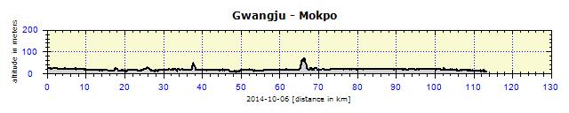
Once again I chose a significant trail along a river — the Yeongsan River. I had to pass across the hilly terrain around the Naejangsan National Park. 45 km later I reached the dam on the Yeongsan River, as well as the 130 km trail leading to and ending in Mokpo. The surroundings of the upper flow of the river were very popular, mainly due to its famous redwood avenue. This was a favorite place for photographs, so it was difficult to take a photo without also having another photographer in it. I committed a small faux pas when entering the avenue on the bicycle. Someone started shouting at me. I turned back and realized I'd missed seeing the sign forbidding cycling and also missed paying the entry fee – a classic 1000 Won (20 CZK or $1). I begged their pardon, paid my entry fee and walked in the avenue for a while. It was more than 1 km long, I did not walk the whole of it. Then I continued my trip, but with difficulty. There were many bicycle rentals and popular four-wheel-bicycle rentals beside the bike path. The children careering along the trail created chaos, demanding slow and careful cycling. There was a funfair on a parallel road, with food stalls.

Metaseuioa Road: The alley is a favorite photographic theme

Junknolwonk: Yeongsan River was narrow at its beginning

Junknolwonk: Sunday bicycle traffic was very heavy

Samji: Typical grassfields along the river
I located Gwangju Park on the map, which seemed to be suitable for sleeping over. I was right – it had all I needed: water, toilets and even a shelter. I went into the city to eat, returned at sunset, pitched my tent and slept well. On the following day, I undertook several short excursions away from the cycle trail. In Naju, I visited an old Governor's Palace, with (for Korea) an atypical U-shaped ground plan. I did not find it interesting and did not even take out the camera. A detour to the biggest Lotus Lake was much better; it must be amazing during the blossom season. A 250-meter-long bridge stretched over it, so that one could enjoy the Lotus flowers at close hand.

Seumgchonbo: Rice grains were the decorative theme of this weir

Naju: Eastern fortress gate

Neueroji: Bends in the river

Neueroji: Lookout

Sanjeong: Hoesan Baengnyeonji – biggest Korean lake with Lotuses
On the road again, I received the (to date) most curious snack from another cyclist. He handed me a palm full of raw rice and warned me to chew it properly. That, surprisingly, worked.

Neueroji: My temporary cycling friend

Near Mokpo: The river by now has reached a respectable width
The cycling trail ended at the sea in Mokpu. The end of the trail with a registration booth was once again the perfect spot to sleep over. Still during daylight hours, I spotted a sheltered pavilion for my tent and cycled into the city to get something to eat. I seemed to have an enormous hunger and had started eating two dinners. I found a supermarket in the center and stocked up for the next day.

Mokpo: City center at nightfall

Mokpo: Esplanade