|
Detour to Cape Town
The Campsite Sucks
I cycled easily to the closer of the two campsites listed on the map of the area around St. Helena Bay, which I had obtained the previous day from the guesthouse. In the Caravan Park, they demanded 135 Rands for a tent site, which was quite a lot under local conditions and the fact that it was not in season. After paying, they dryly told me that there was no running water, but the pipeline was already under repair and would be fixed by 4 p.m. This disrupted my plans – I needed to shave, wash my clothes and cook. I tried to pitch the tent in a strong wind on the site officially designated for it. I could not hammer the pegs sufficiently well into the concrete-like hard ground and twice had to chase the tent around the campsite, after it was blown off by the gale. I finally gave up, moved the tent to the children’s playground in the campsite and anchored it safely on the beautiful lawn. As there would be no running water until 4 p.m., I went shopping at the nearby SPAR. Along the way, I encountered a small pub in the fishing port and had them prepare some fish for me (hake, Cape snoek). It was sensational, naturally cooked, without any garnish. Fresh produce is always recognizable, especially in the case of fish.
I explored the surroundings. The beach was definitely not suitable for swimming. Waves were pounding powerfully against the shore and it would have been impossible to swim there. The fishing port also did not provide any further points of interest. There were some quite shabby fishing boats, prepared for their daily dawn departure. Only after 8 p.m. was there any running water in the camp. The foodstuff I had bought to cook was kept for the following days. I ate in a small seafood pub. I just bought a salad in SPAR as a side dish, so I did not have to eat the French fries, which was all that was offered in the pub. I could not do my laundry, it would not dry in the damp air.

[Laaiplek] Fishing boats
Port Owen
I planned to cycle around the opposite bank of the Gulf of St. Helena, and then move on southwards. But I first went to neighboring Port Owen. This is a resort for wealthier people, a large yacht harbor, new houses, some parts guarded by a security service and accessible only with a pass.

[Port Owen] Yacht harbor
Gulf of St. Helena
The gulf is located opposite Port Owen and therefore the advertising materials emphasize that there you can watch the picturesque sunrises and sunsets over the ocean. The place was quite uninhabited, with a few houses here and there, interspersed with vacant pieces of ground, but with easy access to the sea. Stompneus Bay is situated in the northern section. The northernmost outpost of the mainland is Shelley Point. Similarly to Port Owen, this is a closed community with only new houses, nothing original. The developers are trying to make it more attractive with fountains, statues, restaurants, children's playgrounds, and so on. At the gate, I received a visitor’s card and cycled around the area for a while. It is true that there is a beautiful, long, sandy beach, probably very good for swimming in season, for those who do not mind cold water.

[St. Helena Bay] Old cemetery

[Shelley Point] Statue of Vasco da Gama

[Shelley Point] Beach in a beautiful cove, no good yet for swimming without a wet suit

[Shelley Point] Shore covered in shells
A Dirt Road for a Change
In Langebaan, which I eventually chose as my next destination, the shortest road led back 17 km on a route around the bay. Loyal to my principle that, if possible, I would not return on the same path already once cycled, I hit the dirt road leading from Stompneus Village to Vredenburg. It was 25 km on quite a miserable road, also fairly hilly. I rather enjoyed it, as I like variety. However, my computer could not take it. The problems with the display reappeared. The image on the monitor was fading, which I tried to restore by changing the angle of the monitor and tapping on the keyboard. It seemed that the contacts from the connection of the display and the base plate had been loosened. I did not dare to dismantle the device, for fear of breaking it completely. Perhaps another dirt road with the opposite amplitude of corrugated surface would plug the contacts back in again, what do you think?
The road from Vredenburg to Langebaan is almost flat for 30 km, but I was tormented by a strong headwind, which changed direction in gusts and once tried to sweep me off the road and sometimes to throw me under the tires of overtaking cars. There was no verge on the last 11 km and, in the heavy traffic, my hands were hard-pressed to keep to the narrowest track possible. Drivers there are not accustomed to cyclists, so they usually do not bother to keep larger distances and drive absurdly tightly. Well, so it was I who had to worry, watch out for vehicles in the mirrors, cycle more towards the center of the road and to move as much as possible to the edge of the road just before an overtaking car approached. Only in this way, was I able to secure a safe distance between myself and overtaking vehicles.
I wanted to sleep over in a campsite, so I kept an eye out for tourist signs. Finally, the caravan symbol appeared almost in the center of Langebaan. I cycled to the gate, which a security guard opened for me. He informed me that, although the reception was closed, I could pitch my tent and manage the administrative issues in the morning. This of course suited me. I did not have to buy anything because I had the foodstuffs needlessly purchased for the previous day’s dinner. I was hungry, so I prepared the classic “garnishes” – spaghetti, beans in tomato sauce, tuna in oil and chopped tomatoes. Not a gourmet meal, but a hungry man rather pursues calories than refined taste.
West Coast National Park
This National Park consists of a narrow, shallow lagoon, about 30 km in length. It is lined with salt-water marshes and unique flora. The Park is home to an enormous number of birds, turtles and antelope in the surrounding Fynbos (Afrikaans word for 'fine bush'). I only saw some Eland, among the antelope. Admission to the Park was 48 Rands for foreigners, the rate for locals being about half. These rates are listed on the board at the entrance to the Park, and no one was even surprised or ashamed that the prices were different. In the camp I got a 20% discount for pensioners (which everybody over 60 years of age is entitled to) which paid for this entry fee. In season. when the wild flowers are in bloom, the admission fee is double. A paved road, which connects to the R27 to Cape Town after 25 km, leads through the Park, but it is necessary to pay the full entrance fee for every passenger in a vehicle.

[West Coast National Park] Furthest end of the Lagoon, seen from Geelbek

[West Coast National Park] Flamingos
I took it as a recreation, as I was not racing to get anywhere. I definitely did not want to cycle the whole 80 km, because a strong South wind had been blowing all morning. But because I had to go back along the same route, I knew that I would have the wind behind me, so I considered that to be fair. I cycled about half of the route, turning back in Geelbek where there is an Information Center, restaurant and especially two sheltered hides for bird-watching. The hides have closable peepholes facing the lagoon. I was there alone, so I adjusted them so that I could see perfectly while avoiding the wind. I observed the flamingos for over half an hour. Then I moved to another observation spot, in which a pair of birds was waiting for me and showing off at close range. I opened the shutters for them, but they probably liked it inside and did not fly away.

[West Coast National Park] Bird-watching near the Langebaan entrance gate

[West Coast National Park] Bird hide and photos of its visitors

[West Coast National Park] Fynbos surrounds the lagoon

[West Coast National Park] Salt marshes

[West Coast National Park] Geelbek – you can stay in the former stables
I liked the Park, but some chores lay ahead. I had not washed my cycling clothes for several days at that stage, and the sweaty clothes clung to me quite disgustingly. In the morning before leaving the Park, I had washed my civilian clothes. They had fortunately dried in the meantime, so I had plenty of pegs for hanging up the cycling clothes. And because the weather improved in the afternoon and the tearful, cloudy morning had passed, they all dried beautifully by that evening. As a dutiful cyclist, I took care of the bike too, washed the chain with WD and lubricated everything properly. It was high time, as indicated by the high incidence of towels and similar suitable cloths I had collected along the road in recent days.

[Langebaan] On the beach
In the morning, I gratefully acknowledged that not a leaf was stirring. I set out as soon as possible, because I knew it would not last for long. Fortunately, I was wrong. There was the minimum of wind until noon. One hour later, the wind grew stronger, as is the rule there, but it blew from the West so I had an easy ride with the wind conveniently from 4 to 5 o’clock. I rejected cycling through the Park, not because of having to pay the entrance fee again, but because the road through the Park was very hilly. I went back 11 km to the R27 and turned towards the direction of Cape Town. The wide verge safely separated me from the surrounding heavy traffic. It was hilly, as it is everywhere there, but there was no need to stomp on the pedals, so it was fine. After 50 km, I'd had enough of the noise of heavy traffic, so I turned off inland on the R315. Immediately I began to enjoy myself. Although the hills were more challenging and the road had no verge, most of the traffic had disappeared and I was able to keep an eye on the sporadic cars. And, most importantly, I enjoyed the scenery. There was always something to look at, the landscape changed continuously and I wondered what would peep out at me over the next horizon.
Oh, Darling!
The town of Darling chose the opening words of the song by the Beatles as its slogan. It was just time for lunch, I stopped at a SPAR, purchased some rollmops (local rollmops are very acidic, but the fish is delicious), buns and, imagine, sweetened milk. I had been savoring this combination in recent days, and if I was not positively identified as a male (it is confirmed on my ID card), you might have thought that I was pregnant. It was that kind of craving. And, as usual, I consumed the food right outside the SPAR, in the company of the local black community. The women always sit in front of a store, ranging from moms with young children to old crones, stuffing themselves with food. Some have to sit there for several hours, so they sit on crates borrowed from the warehouse. Their first reaction to me was one of distrust. But I pretended not to notice this. Why, it is indeed natural to squat on the ground and eat food from a bag in front of a store. This varies from time to time, but usually the restraints disappear. I praise their children and I have already even been offered a bite to eat, the highest tribute.
There is a Moravian Church in Darling, and more of them in that area, another one is situated near Mamre. Following the Battle of White Mountain, Protestant exiles from the Czech lands sought refuge in many places and some also settled in South Africa. The main attraction is the famous cabaret, Evita se Perron (Evita’s Perron - the surname is intentionally misspelt.) Pieter-Dirk Uys, famous South African actor and satirist, moved to Darling with his cabaret and his famous character, 'Evita Bezuidenhout'. A miracle happened, the cabaret survived in this one-horse town with people attending it from afar. The cabaret takes place in a corrugated iron hangar on a platform of the railway station. The site is intentionally kitschy, but it has raised awareness about Darling in such a way that one of the major streets of the town has been named after Evita.

[Darling] 'Evita se Perron' cabaret

[Darling] Evita on a poster
It's a Race
I was counting on the usual 100 km. In Atlantis I had almost made it. I did not like the place. The cycling was fine, so I postponed the accommodation search to Philadelphia. Judging by the size of the dot on the map, there might well be something there. It was just a very small village with only one guesthouse. Its two rooms were occupied, but the owner arranged accommodation for me by phone at another house. The owners were to arrive in two hours, to take me to their house. I did not know what I would do in such a – if you forgive the expression – dump, for two hours. I tried to persuade her to allow me to camp out in the garden, but had no luck. The guesthouse was quite luxurious and so a bum in the garden would disturb her image among the guests. She said there was no accommodation in the the south-easterly direction.
It was 3.50 p.m., Stellenbosch was 45 km away, but my legs had already done 110 km. For a moment I considered it, asked about the road surface. It was reputedly hilly but with a gradual ascent. It was now possible to cycle until 7 p.m., so I decided to head for Stellenbosch. I toiled, the wind helped me and I moved like a programmed machine. After 6 p.m. I was already descending from the mercifully located hill down into the town of 200,000 residents. In the guidebook, I located a Backpackers with a campsite, entered it into the GPS and soon I arrived there. Camping cost 40 Rands per night. I booked a wine tour for the next day and pitched my tent in the garden.
Two Danish guys who had bought bikes there and were cycling in the surrounding area immediately took me on to their team. I had not even managed to cook my spaghetti with tuna before being in the midst of a discussion by a Frenchman about the poor quality of the local wine. He had compelling arguments –the environment was too warm, the grapes have a high sugar content and the wine contains too much alcohol. In addition, they are still experimenting with different varieties and therefore have not yet perfected it. On the contrary, in France the same varieties have been cultivated for centuries, the practices are time-tested and perfected and the wine is therefore great. There is something in this because, for example, the wine from the Orange River, where they started producing it ten years ago, was, politely speaking, horrible. Even I could recognize this, and I drink wine to quench my thirst.
Stellenbosch
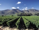
The second oldest town in South Africa, and no doubt the center of South African wine-growing, is cleverly combined with tourism. Just between us, it really is not so difficult to entice tourists to this beautiful region where green meadows and vineyards are picturesquely located on mountain slopes. Towns and villages are scattered in the valleys, with houses of a similar simple style and color, no entrepreneurial Baroque.

[Stellenbosch] House in the center

[Stellenbosch] Courtyard of the office
Wine Tour
The hostel organized a wine tour, with a 10.30 a.m. departure and a return at 5 p.m. There were two minibuses of visitors. It turned out to be a very pleasant experience for all of us. We visited four wine farms in the vicinity of Stellenbosch and Franschoek.
The first wine farm was the famous Simonsig, close to Stellenbosch. They are very proud of their sparkling wine which they were the first to start producing in South Africa. It cannot be called 'Champagne' as this is a geographical indication. The visit began with a guided excursion through the winery. Then we were given a mini-course on how to drink wine – first to nose it (it is not called 'smelling' or 'sniffing'), then to roll it on the tongue and finally to swallow it. We had the procedure graphically demonstrated by the leader-cum-driver of one of the minibuses of our tour. He was obviously enjoying the tasting so much, that I asked him privately what the law was regarding drink-driving in South Africa. He explained that 0.05g per 100 ml of blood was permissible, but they were still trying to impose zero tolerance as in the Czech Republic. At first, we were given a glass of sparkling wine and a list of wines to taste, with the prices, in case we wanted to buy any. It was pointed out to us that if we did not like a particular wine, we could just pour it into the designated containers and taste another one. The recommended procedure is to start from the light white wines and then to drink one’s way to the heavier red and dessert wines.

[Vineyard Simonsig] Local sparkling wine maturing – Simonsig was the first winery to produce it in South Africa

[Vineyard Simonsig] In the foreground are two important items: on the left, a pitcher of water, on the right, a bucket for pouring discarded wine into
I skipped the whites, starting with the most expensive local red, Redhill Pinotage, at 220 Rands per bottle, tasted it and went to pour it out. By a method of trial and error, I selected two reds which tasted good. Coincidentally, they were also among the cheapest wines on the list. Perhaps I do not have the right taste for those refined vintages and the commercial, broadly acceptable wines suit me the best. It was interesting how one’s taste became sharpened when changing wine samples. It was only necessary to intersperse them with a glass of water.

[Vineyard Fairview] There are several circular counters, each with two assistants serving wine

[Vineyard Fairview] Cheese tasting – goat's milk Camembert with fig jam was really insidiously good
The next wine farm was Fairview, which also offered a cheese tasting of the cheeses made on the farm. They had an amazing goat's milk Camembert. Dipped in fig jam, it was a gourmet treat. Here I also ventured to taste some white wines and enjoyed a local rosé which I could also drink to quench my thirst. We drove to a Franschoek restaurant for lunch and then climbed up the hill to Dien Donné wine farm. They had a wonderful view from the terrace on which they were preparing for a wedding which was to begin soon after our departure.

[Vineyard Dien Donné] Grapes are grown on the slopes above the town of Franschoek
The last wine farm visited was Boschendal, the second oldest winery in South Africa, founded by the Huguenots, who were forced to flee from religious persecution in France. Here they had a completely different procedure from the other wineries. A set of glasses with tasting wines was prepared for each person, nicely sorted from the lightest to the heaviest. And again their rosé wine proved the winner for me. There is a beautiful garden near the winery, with a park in which people were picnicking—just an idyllic Saturday. Most wine farms organize free tastings, anyone can come to taste as much as they like and then leave without buying a single bottle. However, this would actually be stupid, as the prices are very low, so why not buy a wine one likes? There was only a fee charged for the cheese tasting – I think 12 Rands, which was included in our total tour price.

[Vineyard Boschendal] Everyone receives a set of wines to taste

[Vineyard Boschendal] The original farmhouse

[Vineyard Boschendal] Garden of the wine farm with views of the surrounding mountains
A Day filled with Miracles
This heading is not a great exaggeration. The first miracle was the breakfast. After the half-kilo portion of vegetables, a chunk of cheese, bread, porridge and Strudel, I set out completely fresh. The digestion of such a quantity of food did not affect my performance at all during the first hour of cycling. After about 20 km, I passed the vast township of Khayelitsha. It is quite civilized under local conditions – there is electricity, high columns of electric lights like those found in sports stadiums illuminate it at night, groups of prefabricated toilets, apparently there is also running water and sewerage. However, the shacks are pretty miserable and crammed tightly next to each other. This minimal privacy inevitably must have an effect on the psyche of the residents, creating a breeding ground for the functioning of various religious sects. I saw two such religious groups at a crossroads. A sect in white robes was holding a Sunday service. The second group of women was sweeping an area for some wild dancing, or rather squirming, apparently a warm-up before worship. It seemed to me stupid to stare at them openly, so I rather left before any actual miracle could occur.

[Khayelitsha] A vast township

[Khayelitsha] Electricity is provided to the township; huge lamp posts for public lighting resemble sports stadium lighting. I also saw toilets, always 5 booths joined together

[Khayelitsha] Worship at the crossroads
The Indian Ocean
The R310 road dropped slightly before reaching the ocean. Lined up next to each other like pearls in a necklace were the sandy beaches with very fine, white sand – Macassar Beach, Mnandi Beach, Sunrise Beach. There were many people everywhere, children paddling in the water, which, however, was not yet warm. Heavy traffic, a road without verges, in addition narrowed by the sand blown on to it. Twice a car forced me to move on to a sand drift and it was only by a miracle that I was not injured. This would have been rather ironic near the end of my trip. I arrived in Muizenberg, where there was a total traffic jam due to the Sunday market being held at the town entrance, near Sunrise Beach. Then began a continuous series of small towns - St. James, Kalk Bay, Clovelly, Fish Hoek.

[Muizenberg] The Sunday market with many visitors, accompanied by a traffic jam

[St. James] The familiar colorful changing booths at the tidal pool near the railway line

[Kalk Bay] Seals entertain visitors to the local market
A Whale
The greatest miracle occurred in Kalk Bay – a whale with a calf was swimming near the pier. People could observe them from the pier from a distance of about five meters. I saw them from the street, where I had just wrestled with a traffic jam amplified by a closure of one half of the street. I quickly took a photo of the whale, went on to the sidewalk and rushed towards the pier as quickly as possible. But I only saw her swimming away into the bay. The road fortunately led around the bay, along with the sidewalk, so I could comfortably watch her journey across the bay. For about half an hour I enjoyed this very rare sight, because even the locals were not accustomed to this sighting, it arousing widespread attention. The whale swam to about 500 meters from the beach of the fairly large town of Fish Hoek, before suddenly diving under the water and I could no longer see her.

[Kalk Bay] A big whale with a calf near the Kalk Bay pier

[Kalk Bay] Whale and calf swim out far into the bay

[Kalk Bay] The black line approximately in the center is the whale
But the day was not yet over. I located a campsite on the map, at the entrance to Simon's Town, on the other side of the town. The lady outside the Reception told me that the price for camping was 100 Rands. It was up there and I was to pay in the morning because her daughter had already left the office with the keys. I asked about the offer of 200 Rands per night advertised beside the road. "Yeah, that applies to those cottages. If you want one, number 1 is still free." So I took it. We waited ten minutes for the daughter, I was given the keys and wanted to pay. "Give me all the money you have," the receptionist said with a laugh. I replied: "I have already given it to my wife," and handed her 200 Rands. She took only a 100, saying, "You wanted to camp, so your price is 100." Really great! This would not have happened in our country.

[Simons Town] I stayed in the cottage between the poles
Penguins
There is a huge colony of African penguins at Boulder Beach, about one kilometer from the campsite. Of course, it is a great tourist attraction with everything that goes along with this, but is still a very exciting experience. The penguins can be observed from a wooden boardwalk. Some are virtually at your fingertips. The previous year, it had cost me lots of money and more than half a day to reach an island with a colony of penguins. Here you can observe them even from the road if you do not feel like paying the entrance fee.

[Simons Town] Penguins in their environment

[Simons Town] This penguin colony is actually in the city

[Simons Town] Penguins on a rock

[Simons Town] People watching penguins at close quarters
The Cape of Good Hope
Although Cape Town was the final destination on my trip, the idealistic destination was the Cape of Good Hope. The Cape is located in the Table Mountain National Park, the entrance fee to which is 90 Rands per day. There are paved roads in the Park so cycling is pleasant, though hilly. First I went to the Cape, which is where the two oceans – the Indian and Atlantic – meet. As I approached, the words of a poet came to mind: "Before one starts to hope, here comes the Cape of Good Hope." Originally I intended to take a funny photo there with the bike, but that proved to be impossible. Although I arrived just after 10 a.m., I could not avoid the tour buses. These tourists had only one desire, to have a photo taken at the notice board. First the whole group, then individually, in couples or threesomes, according to their wishes. Each busload took about 20 minutes to do this, with waiting crowds of people from other buses lining up. For most, this was enough and only a minority of them went to view the surrounding area at least for a moment. It might be good business to erect a few similar notice boards with a corresponding background setting, so that tourists could have a few photos taken there, saving them the time and money to actually travel to the Cape of Good Hope. I present this idea to you free of charge.

[10 km west of Simons Town] The blue Cape of Good Hope is already visible in the distance

[Cape of Good Hope] The ideological destination of my trip lies just ahead

[Cape of Good Hope] Tourists are only interested in having their photo taken at the signboard

[Cape of Good Hope] After an hour's wait, I am able to photograph the board for a nanosecond without any smiling tourists in front of it
My encounter with a couple of Japanese cyclists travelling across Africa was far more enjoyable. Hiromu Jimbo (the guy) had started off in Istanbul, with Megumi Homma (the girl) joining him in Kenya. I described my Japanese trip to them and managed to fish out several Japanese words and phrases from memory which they even understood. Hiromu was my kind of cyclist, the frame of his bicycle nicely discolored from rust and, instead of the stand which had broken, he used a forked branch of about a meter in length, with which to prop up his bike. I gave them my card and they gave me their e-mail addresses so that we could contact each other later.

[Cape of Good Hope] Japanese cyclists at the end of their African tour
The next stop was Cape Point, a hill with a lighthouse overlooking the Cape of Good Hope. In the parking lot I met two Germans, about 40 years old, on a three-week trip around the Cape region. Previously I had met them between Barrydale and Robertson. In the three weeks they had covered 700 km. They had just arrived that day from Hermanus by minibus. It could be seen on them, their beer bellies nicely stretching out their cycling clothes. Instead of pedaling the 50 vertical meters to the lighthouse, they preferred to eat in the restaurant in the parking lot. They left a long time before me, but I caught up with them after 15 km and on the uphill, simply left them standing.

[Cape Point] Lizard

[Cape Point] View of the Cape of Good Hope

[Cape Point] View towards Simon's Town

[Cape Point] Lighthouse on the left, cliff on the right
Chapman's Peak Drive
Of course I could not miss this legendary drive. It leads high above the ocean, partly cut into the cliffs. Because the ground clearance is only 220 cm, it cannot be used by buses or trucks. It is also often closed due to landslides and falling rocks. The condition of the road is stated on the board at the entrance. It is a toll road, the fee being payable in Hout Bay. For a motorcycle, the approximately 12 km costs 22 Rands, bikes are of course free. Where money is concerned, there are always artful dodgers. I myself saw a risk-taker who drove along half of the route, making eight U-turns on the narrow road full of blind corners. Perhaps he saved 32 Rands for his car's passage, but the price could have been much higher. The road affords beautiful vistas, with several observation spots where cars can park. However, I could park my bike in a drainage ditch and take photos anywhere.

[Chapman's Peak Road] View of beach from Chapman's Peak Drive

[Chapman's Peak Road] The surfer was really skillful

[Chapman's Peak Road] Nets hold back falling rocks, the road is sometimes closed due to rock slides

[Chapman's Peak Road] The road is cut through the rock, buses and trucks fortunately cannot pass through

[Chapman's Peak Road] View of Hout Bay
Hout Bay is practically in the city of Cape Town, which is less than 20 km away. I wanted to pitch my tent at the Hout Bay Backpackers. The option of camping was mentioned in the "Coast to Coast" Backpackers' brochure. However, meanwhile this one had closed, and there was no campsite in the city. Accommodation at the Backpackers was expensive, but the owner recommended a cheaper guesthouse to me, and even walked with me down the road to show me the way. So, unfortunately, I would not be sleeping in a tent again that year, the last time having been in Stellenbosch.

[Hout Bay] Harbor
Cape Town
It poured with rain in Hout Bay until 10 a.m. About 20 km lay ahead of me, depending on the route I took. Due to the weather, I chose the shortest, most hilly route. In Cape Town, damp from the drizzle, I sweated when ascending from Camps Bay along Kloof Road to the saddle between Table Mountain and Lion’s Head. Thus I avoided passing through the center of the city and also the traffic density was much lower. Thanks to the GPS, I did not even get lost in reaching the Zebra Crossing Hostel, where I had reserved accommodation for the first four days. This was the only hostel with a free single room and the reviews on hostel.com were also very favorable. Only the price was suspiciously low and so I expected something horrible. In the end it was OK. The room was clean, small, but the bike and everything else fitted in it. I walked around a few hostels in the vicinity, but skipped those on Long Street, which is a street lined with pubs and so noisy at night that it is impossible to sleep there. I did not find anything better, so I arranged for a bigger room from the following day and three days later I was able to move to an even larger room.


|