| Cycling South Africa |  | |||||
 |
 |
 |
 |
 |
 |
 |
| Nothing compares to the simple pleasure of a bike ride. J.F.Kennedy | ||||||
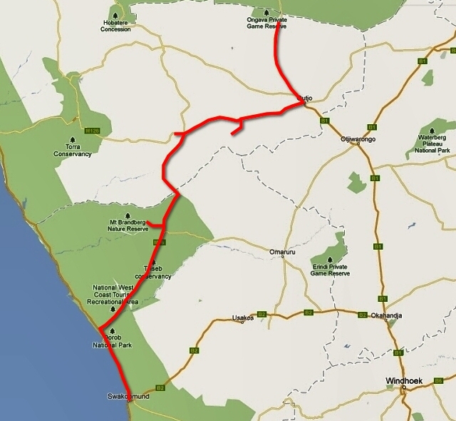
| Three-month cycling trip, starting in late August 2012 in Windhoek, ending in Cape Town. Author's 9th expedition (New Zealand, Australia, USA, Canada, Alaska, Japan, Mexico, Bolivia, Chile, Argentina). |
|
To the Atlantic Ocean
Direction: Atlantic Coast
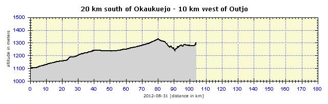
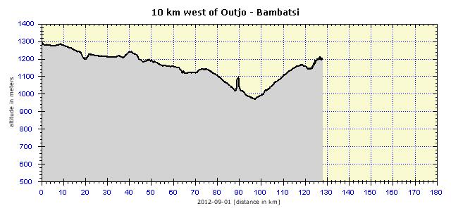
In Outjo Again
Three women from the Himba tribe appeared in the store. They are characterized by being naked from the waist up, except for the bands of bracelets on their arms. Unfortunately, they were clearly aged 40+ and gravity had obviously taken its toll on their charms. In addition, I do not know what perfume they were using, but it did not smell like Chanel No. 5, rather like Skunk Extra Strong. By the way, the younger members of the tribe try to commercialize their appearance and stand alongside the roads bare-breasted, allowing tourists to photograph them for money. I found it embarrassing, so I refused their offers, even though, as a socially inferior traveler who could only afford to travel by bicycle rather than by car, I would have been granted a substantial discount. I arrived early at Sophienhof Lodge, just after 1 p.m. I opened the gate, but found nobody there. Then I saw some snoring black workers in the adjacent camp, who explained that it was very hot and the reception would only open at 2 p.m. I ate some of the food I had bought at the supermarket, grilled beef cutlets and pasta, and drank three-fourths of a liter of my favorite Windhoek Lager – really an excellent beer. I checked in, pitched the tent, washed my clothes and read the Kindle for several hours. I felt great. I got up at 5 a.m., as I wanted to get to Khorixas. At breakfast, a local tame ostrich was annoying me, examining my food. I even had to wrest the packaged cheese from its beak.
Cycling, however, was great. Undulating landscape. I really began to enjoy the ride, knowing that I would be in Khorixas pretty soon. However, as is usually the case with me, my travel plans had to be adjusted. After about 70 km, I discovered a turn-off to Finger Rock, one of the local landmarks. Ugab Terrace Lodge with a campsite was in that vicinity, so I thought that I could cover the 20 km on the dirt road and at least practice cycling on dirt roads, on which I would be spending the rest of my time in Namibia, anyway.
Finger Rock
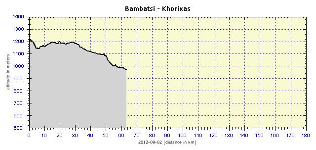
Bambatsi Lodge
Dinner was great for many reasons. The main course was Oryx Steak. The Oryx is a type of antelope, which I describe collectively, not having a deeper knowledge of all the local deer and other wildlife. Several times I refilled my plate, as many others were doing, thus preparing my system for the next long slog. The conversation at the table was particularly interesting. I was sitting in the place of honor on the right of the hosts – I was the most exotic person and the only non-German present. I listened to the lady of the house chatting animatedly with the German women, her paying guests. The essence of her communication was: “I’ve got 1,000 hectares of land, 40 African servants. In Germany this would not be possible.” I told her that she really had a great life and that perhaps she should be more tolerant. She looked at me, for a moment nodding her head and then laughed, commenting that I was right and that I was the only person to understand what a wonderful life they were leading and that this would not be tolerated anywhere else but in Africa. On several occasions, I realized how easily people here solve things that are complicated and expensive in Europe. For example, hot water is needed in the camp in the morning and in the evening. In Europe, you buy a boiler, connect it to the electricity supply, set the times of switching on. Here you buy a cheap wood-burning boiler and in the morning and in the evening one of your “tanned amigos” comes to heat the water up. Almost zero cost, satisfaction high, that is, if the boilerman isn’t drunk and actually comes to work.
The master of the house was also amiable. An imposing figure with a huge belly. He ate very abstemiously, eating only half of his steak and two small potatoes. He left the table at regular intervals, returning happily with a shiny face. But he told us some interesting things. Wild desert elephants live in this area, and although there are not many, they ravage the farmers' crops. Two years previously, they had trampled the campsite which was below the top of the hill about 3 km from the farm. Luckily no one had been in it at the time.
He who Drinks Gasoline
I stayed in the campsite opposite the store, which was de facto the center of the town. It was a Sunday, and so the beer fridge in the self-service store was locked to stop sales. There was a restaurant in the camp, so it was not that big a problem. However, in the evening I went for a walk outside and, about 100 meters from the campsite, there was a store gaily selling beer, wine, liquor, regardless of the generally applicable ban. I had plenty of time and so I devoted it to the bike. I walked around the quite large camp, found a discarded hose and, a short distance away, a tap with running water. I washed the bike thoroughly, checking all the screws on the pannier racks. I had already pumped air twice into the rear tire, so I checked the inner tube. It was not punctured, but the valve was leaking slightly, so I changed it. This was a totally new inner tube by Schwalbe and it was the first time that this brand had disappointed me.
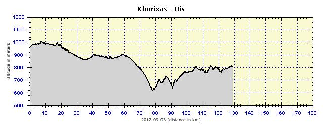
Too-Clever GPS
So I headed off really early, it was quite cold and the last 10 km on the paved road did not warm me up very much. The subsequent dusty road, however, took care of a proper bodily temperature. It was a main route, so I encountered about 50 cars during that day. The road was quite good, especially its width, which could contain four lanes with still enough space for wide verges. The surface was less ideal, sometimes excellent, sometimes buried in sand, requiring continuous dodging and searching for the optimal track. Likewise, it was not possible to effectively convert potential energy into kinetic (that is, to cycle fast downhill and utilize the speed thus obtained for the opposite uphill). The foothills – valleys – were almost always filled with sand, with deep corrugations at the beginning of the climb. With regard for the bike and the electronics it was carrying, I tried to ride over bumps from the saddle to minimize the impact. But it did not always work and then my hands would vibrate as if wrestling with a pneumatic drill. But do not take this as a complaint, I have cycled on far worse unpaved roads and these local roads were among the best.
There were only two villages en route, both near the dry Ugap River. The shacks were patched together from different materials, the best of these being sheet metal, no glory. People traveled by donkey cart. On one hill I saw that two of the four donkeys on the yoke had fallen down from exhaustion. There were two guys, one of them began to crack them violently with a whip while the other kicked the fallen donkeys on the head and neck. I cycled around so as not to fall victim to this treatment too.
Providently, I was carrying about four liters of water in the bellows. And I needed it. I had already drunk 2.5 liters from the bottles in the early afternoon. This had never happened to me before. But as it happened, somehow I had not fixed the water sack to the sleeping bag's cover, which was tied to the rear horizontal carrier. It was becoming loose all the way, hanging from the rear wheel. I was trying to adjust it all along the way. The result was that the flag blew off somewhere and I would have to find a piece of wire to hang up the spare flag. By the last 30 km, I'd had enough. The road was almost constantly rising, but abruptly, so only after reaching the horizon, did I learn that the climb was continuing. In the afternoon a strong headwind joined in. It blows regularly from the ocean there. There are no coastal mountains to shield the wind a little, and so it penetrates far inland. I really suffered from seeing the road sign "Uis 10 km" and my drug was the mirage of a cold and dewy Windhoek Lager floating above the hill. By the way, it was 15 km and not 10 km, as I noted the following day. Well, I had two beers eventually and ten minutes later felt like a king again. It is really interesting how all the suffering is forgotten immediately after the finish and only the feeling that it has been quite good remains.
The White Lady is a Man
Uis was 36 km away, and so I rode there. Cycling without a load was quick and in less than two hours I arrived at the site. I paid 50 N$ and was assigned a guide, as one is not allowed to go there alone. The walk to the paintings is just over 5 km in total, but with the chattering guide, who at times had to stop to smoke a hand-rolled cigarette, it took almost two hours. We met tourists coming from the opposite direction. Thus I again encountered the French couple with whom I had been on the all-day tour of the Etosha National Park. Many people told me that they had seen me on the road. And they asked how I was coping with the dust, that it must be terrible. I replied that I let the dust cover me and in the evening I just took a longer shower. My guide laughed at that like a little child. He told me, slapping his thighs, "You really think like an African, there is dust, so you just let the dust cover you!" The 2000- to 4000-year-old paintings are under a surprisingly small overhanging rock. The older paintings are monochrome, the more recent ones are in color. The White Lady is definitely a guy, because he is displayed with a penis. I do not know why the truth was revealed only 50 years after the discovery of this rock painting. However, there are more interpretations of the image. Most agree that it is a healer performing a ceremony – probably summoning the rain. The whole valley was currently completely dry, except for a puddle 3 square meters in size, but in the rainy season (November, December) a big river flows through the valley. The guide showed me the place where there is an impressive waterfall in this period.
Downhill, Hard Labor
When the wind started to blow, my fun was over. Although the road was to descend towards the ocean, I had to check the inclinometer on the cyclocomputer to see that I was really moving downhill. The landscape was dull and so I was looking forward to the coastline. In the evening, I arrived at the coastal Salt Road, which is indeed made of sand and salt. It was perfect, like a good paved road, so I was looking forward to cycling on it the following day.
I reached the campsite in Henties Bay, having originally thought it was some kind of factory for prefabricated components. About 30 shelters were arranged in perfect alignment on the sand-covered area. Each contained a shower, toilet and sink with a kitchen hob, so each tent site had its own facilities. I rang for the reception and nothing happened. After a while, a ragged black man shuffled in and told me to give him 140 N$ and he would accommodate me. I protested that I wanted to register officially in the guest book and get a receipt. Sure, no problem. This was really the Manager, although he looked like a tramp. I locked everything in the bathroom, went to the nearby SPAR, bought some food and cooked a pile of beans with ham and tomatoes. Only then did I pitch the tent and realize how cold and unpleasant the area was.
Salt Road
At about 10.30 a.m. the fog lifted, the wind began to blow a little and, with the sun, changed the muddy sewer into a comfortable hard road within half an hour. I cycled on to Swakopmund, as filthy as a pig. I knew that I would hardly find accommodation in that state, so I went to a gas station and said I wanted to wash the bike. Immediately two young men took charge of the washing. I thought that they had the equipment for this, that they would use WAP and it would be done. Not a chance. They commanded me to go to a water tap, pulled out a half-meter piece of hose and a broom and began to clean the bike. But they made almost no progress, the mud was solidly stuck to the bike. After half an hour of hard work, the bike and bags were covered with an even layer of brown dirt. Nothing could be done about it. I would have to find a car-wash with WAP, but only after I had found some accommodation. I checked about three addresses in the guide book and arranged accommodation at one of those. I originally wanted to book for three nights, but while searching for accommodation, I also toured the city and it was clear to me that two nights would be sufficient. I chose a hostel where I was able to take the bike into the room. In the car-wash across the street, two boys licked the bike into shape and, after a few minutes of work with WAP, the last memories of the morning adventure had disappeared. I polished it with WD and then greased everything and the bike was in tip-top condition again.
Swakopmund
       |


")

")